Published: 16/04/2021
In this candid online event, hosted by Dr Inken Braunschmidt, Chief Innovation and Digital Officer at Halma, Navtech Radar’s Founder and Managing Director, Philip Avery, and Oxbotica Founder and CTO, Professor Paul Newman discuss how they joined forces to develop a new radar based localisation solution that is unlocking the full potential of automation with proven accurate localisation, even in the harshest conditions and environments.
They are also joined by Mike Woods, Chief Technologist at BAE Systems Maritime Services who talks about how they are already applying this advanced technology to bring a new level of capability to their marine operations.

Dr Inken Braunschmidt, Chief Innovation and Digital Officer at Halma

Phillip Avery, Founder and Managing Director at Navtech Radar

Paul Newman, Founder and CTO at Oxbotica

Mike Woods, Chief Technologist at BAE Systems Maritime Services
The radar can be mounted on the front, side or back of a vehicle. The system can operate as normal with a restricted field of view e.g. 130°, meaning only one radar is required per vehicle.
You can fit the radar sensor to the front of the mining vehicle and simply just use 180° of its range. In the case of a recent train trial, a single sensor was mounted on the front of the train to provide 180° coverage.
It is very easy to install. You simply plug it in and it outputs position information, rather like a smart sensor. Only the most basic integration is needed, such as connecting with a power supply.
The technology is better because it operates in all weather and light conditions, including underground, unlike GPS. The only case when it would fail would be in a place where the radar sensor gets absolutely no reflections back from its environment. Somewhere that is fully radar absorbent, for example, where it is utterly flat. One would assume that in the Arctic, for example, it would not work, but we have tested the radar in the Arctic and in other sparse environments and it has performed reliably.
We have tested the technology in mines, ports, on boats, cars and trains. In every circumstance with successful results.
No, Terran360 is a localisation system, it does not do object tracking. However, clearly, radar is often used for object tracking. This will be a new product offering coming soon. If you don’t want to wait, customers have access to the standard output of our imaging radar.
It provides yaw, but not roll and pitch.
Uncompressed, a map is less than 10 MB per km. This is low when compared to Laser, for example, which can up be up to 1 GB per km.
The system doesn’t need training. It does need a map, however it quickly and easily creates a multi-experience map for you, the first time it moves through your environment, without any need for external infrastructure. The system also features ego-motion estimation, so even without a map, it provides position and velocity estimation through accurate dead reckoning.
Terran360 builds a map of its workplace. The maps are very small, light and quick to create. The system is also aware of how it is moving, irrespective of a co-ordinate frame, through ego-motion estimation.
Mapping updates are possible but rarely needed. Radar maps are much more stable than vision and laser maps. But of course, Terran360 gives a lightweight way to update your maps should you need to.
It is not a SLAM based solution. However, it does produce its own maps and it can output both relative and absolute position depending on how the map is built.
The solution operates entirely independently from GPS/GNSS. To demonstrate its capability to you, we can ground-truth the performance of Terran360 with GPS, and then run it without it. We would encourage you to contact us for a trial, so we can test its performance for your application as a proof of concept. As Terran360 operates entirely independently, its performance is unaffected by GPS jammers and is consistently reliable.
It fits very well, particularly because our radar requires no servicing throughout its lifetime, and mechanical scanning not a cost driver. For Terran360°, off-road industrial automation is our primary market.
As a solution, Terran360 which uses Navtech’s 360°, long-range, all-weather, high-resolution radar is cost-efficient, without you having to compromise on reliability. Set up is infrastructure-free with no need to install physical beacons and integration is simple. A single sensor solution, the radar also requires no maintenance for its product lifetime. By providing reliable, continuous localisation information in all conditions, Terran360 can enable you to unlock the potential of your autonomous operations, so you can increase safety, productivity and efficiencies to give you a competitive advantage. It is a world-first in radar localisation. As a radar, the Navtech sensor offers different capabilities to Lidar. It’s proven, it’s been out in industrial automation and running ports for 20 years.
Can this technology be used across port operations, including ship docking, warehouse operations and hinterland traffic? Is it also possible to use for military, airport, and mining applications?
Navtech and Oxbotica have carried out many proof of concepts. Using the solution on airports would be fine as there are plenty of reflections. Unless you have an area with no reflection or where everything is moving such as in the middle of the sea, then it will work. It will work across port operations, we do have customers who are looking at using our technology for the last 50 metres of ship docking which the high-resolution radar is superior to conventional navigation radar.
We have trialled our technology for rail localisation. Providing other information about the environment is not a feature of Terran360, however, it is a capability we could provide in another offering in the future. The raw output of the imaging radar is available for customers to use and do development with through Navtech’s SDK.
We haven’t tested Terran360 in this environment yet, but we’d very much like to do so. We don’t expect there to be a problem, however we always recommend that as a first step you carry out a proof of concept with the support of our technical team.
Absolute position is of the order of a few centimetres. Orientation is of a fraction of a degree in typical use cases. Results are available on request. Yes, confidence measures are available, but not specifically HDOP.
It depends on the radar cross-section of the object you are looking at. The radar sees grass and vegetation and undulations in the ground, as well as a large objects, for hundreds of metres. Each application is different and we would advise that you trial the system. The radar scans at four or eight Hz, and position updates are available at higher rates.
No, there is no transmitter or receiver on board. It is for the host vehicle to forward the data. It is not something we provide.
The size of the antenna is the driver of the dimensions of the hardware. Navtech will be releasing an even smaller sensor that will work with the current software in 2022.
No GPS is required, and the system currently runs on a one Watt processor.
The algorithms are proprietary and are key to delivering on the accuracy and reliability of this world-first localisation technology, together with the all-weather, radar technology.
The solution is not designed for this application.
We are already working with partners on proof of concept trials for their specific applications. Please get in contact if you’d like to organise a trial.

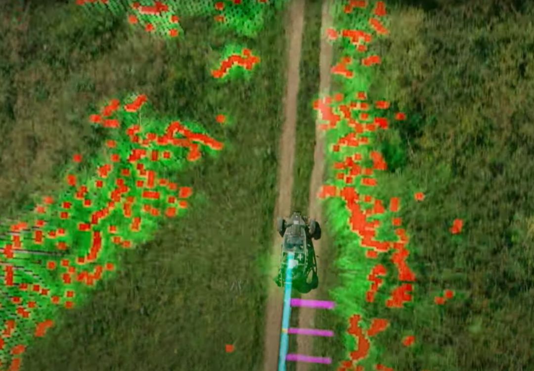
Performing to a centimetre accuracy, our world-leading localisation solution enables the autonomous vehicle to answer the fundamental question “Where Am I?” in even the harshest environments.