Efficient and safe management of dry bulk materials poses unique challenges across various industries. Whether it is stockpile mapping for volumetric measurement, optimising throughput, or detecting safety hazards like boulder falls, face collapses, and weather-related erosion, reliable sensor solutions are essential. Additionally, blockages in underground removal systems or rock crushers require real-time monitoring to ensure uninterrupted operations.
Traditional sensor technologies face significant limitations in addressing these needs. LiDAR, while accurate in clear conditions, struggles in dusty and harsh environments, leading to rapid degradation and unreliable data. Similarly, 2D radar, while robust in adverse conditions, lacks elevation data and requires multiple units to cover large areas, increasing cost and complexity.
An articulated 2D radar (3D) provides the ideal solution by combining radar’s durability in dusty conditions with multi-angle scanning, for a broader field of view and reliable elevation data. This approach enables accurate, real-time depth perception across large areas, providing high resolution, and volumetric measurement capabilities to redefine dry bulk handling automation, reducing system complexity and cost.

The Navtech RAS6 Radar, paired with advanced data processing and a servomechanism, creates a high-resolution 3D point cloud, capturing comprehensive spatial data in even the harshest environments. Mounted on a rotational mechanism, the radar captures multiple layers of data transforming 2D scans into multi-dimensional insights, ideal for stockpile management, safety monitoring, and volumetric measurements even in harsh conditions, such as dusty, foggy, or low-visibility environments commonly found in bulk handling and mining sites.
The radar supports multiple data rate and resolution modes, each suited to specific application needs:
| Mode | Horizontal/Vertical Resolution | Max Scan Rate (Degrees/sec) |
| 4Hz, 800 Azimuth | 0.45° / 0.45° | 1.8°/sec |
| 4Hz, 800 Azimuth | 0.45° / 0.9° | 3.6°/sec |
| 8Hz, 400 Azimuth | 0.9° / 0.45° | 3.6°/sec |
| 8Hz, 400 Azimuth | 0.9° / 0.9° | 7.2°/sec |
These modes provide flexibility in balancing scan rate and resolution. For applications requiring high detail, such as volume measurement, the 0.45°/0.45° mode offers exceptional clarity. For faster scanning across larger areas, the 0.9°/0.9° mode allows for quicker updates at a reduced resolution, which can still be sufficient for broad monitoring.
Example Application: Quarry Rock Face and Stockpile Scanning
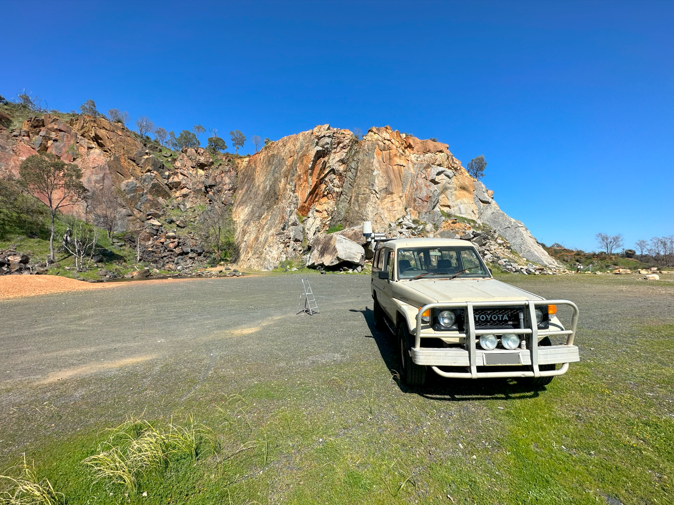
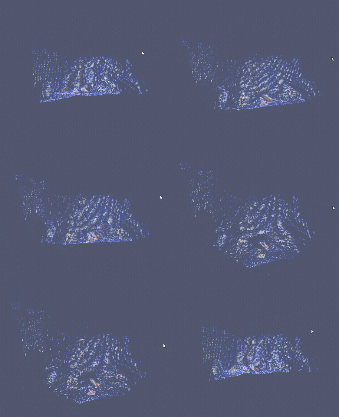
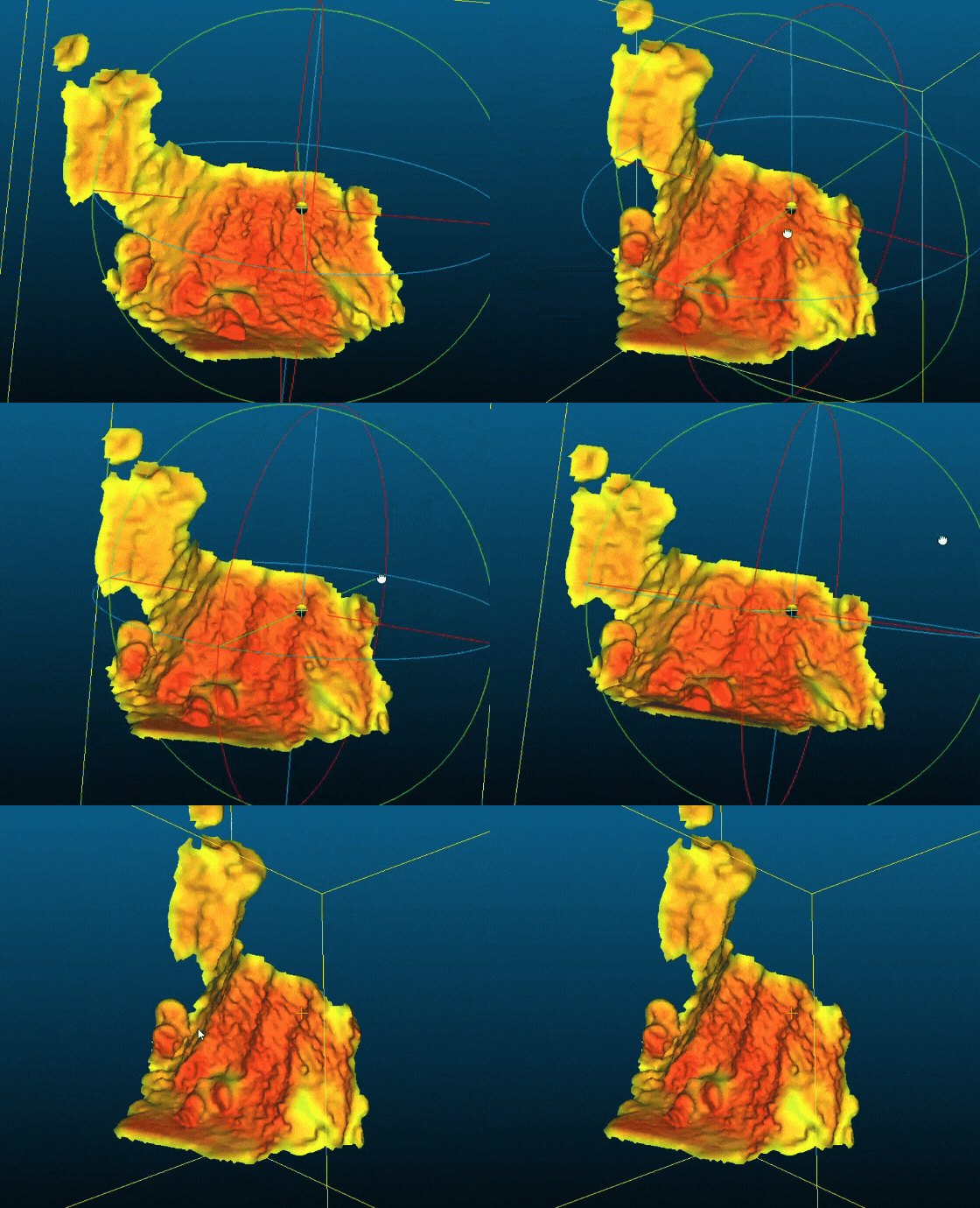
In a recent trial at a quarry, the RAS6 Radar was mounted on a vehicle to scan a rock face and the remaining terrain post-material removal. The 3D point cloud provided actionable insights into the terrain’s shape and residual volume. This data, visualised through software like Paraview, highlighted the radar’s ability to map and measure large areas, enabling better decision-making for material handling and safety monitoring.
The test demonstrated the radar’s capacity to:


On–going partnerships with automation and software providers are focused on refining the RAS6 Radar’s integration and enhancing data processing capabilities. This collaboration aims to streamline deployment, optimise data visualisation, and improve real-time responsiveness for bulk handling and mining operations.
3D radar scanning, exemplified by the Navtech RAS6, represents a leap forward in stockpile management and safety for dry bulk handling industries. From volumetric measurements to real-time safety monitoring, radar’s resilience and precision offer unparalleled advantages over traditional sensors like LiDAR.
By adopting radar-based solutions, industries can improve safety, optimise operations, and confidently navigate the challenges of harsh, complex environments.